This year, I finally used the Boston Marathon as more than a thinly vialed excuse for my employer to give me a day off of work in April! And really, that isn’t so much an action on my part; this year I biked the entire Boston Marathon route. On Marathon Monday no less, albeit, at midnight. My room mate Ben and I managed to goad each other into doing it without so much as return trip from work (11 mile) warm up. I am so sore, but it was a good introduction to exercise season and a little awesome. We were joined by my friends Jed and Ed, a handful of their friends and ~240 others on a trip organized by Boston The Societies of Spontaneity.
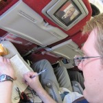
Ben and I did give our bikes a test ride earlier in the day. Ben discovered that this bike had only one working gear because the chain wouldn’t transition between sprockets in either the front or the back. I discovered the cause of the known slow leak in my front tire when I put it up to 100psi and it became a much less slow leak. I was able to replace my tube with one my room mate Andreas had around, and Ben was able to borrow a working bike from his Dad. We also managed to cobble together a headlight and taillight for both of us. My bike has a pedal powered light, but I knew I would be in no shape to pedal up heartbreak hill while also lighting the way. Thanks to Andreas, I didn’t have to; he donated a used taillight and brand new headlight to me!
 Ben and I set off at 8:30pm to Harvard Square and then took the T to South Station where we meet up with the group at took the 11pm commuter rail to the Southborough stop, which is 3.1 miles from the start of the Marathon. We did spend a whole lot of time at South Station; we arrived there at 9 (as directed) but that was a crazy early direction. The train was to board at 10:15, a special early boarding to accommodate all of us with our bikes, but it didn’t board till 10:40; still it left on time.
  It took the train an hour+ to get out there because, as the last train of the night, it must make every stop. Strangely when at Southborough the train stopped twice, once for “normal” passengers, and once for the bikes, despite that the platform was plenty long enough. I passed the time playing Spot It (a card game) and Androminion (Dominion for Andrioid).
The first 3.1 miles consisted of a dreadful uphill, followed by a nice downhill, then an even more dreadful uphill. The road was alight with blinking taillights for more than a mile as the hill separated the serious riders from us, but there was mostly a continuous group. Since the second of these hills was not on the route itself, and everyone was waiting at the starting line, I conserved my energy and walked up most of it. I was glad to be set for a net downhill the rest of the way.
 On Monday April 18th at 12:47:27am 2011 Ben tweeted that we’d started the Marathon. Then we ended up near the back of the pack because he had to put his phone away. The Marathon starts with a huge downhill. The roads were not closed, but the range of speeds and the need for space was so great that the bikes took up all of both lanes of the road. Luckily the roads were pretty deserted at midnight so that was not a problem. On the downhill Ben and I caught up to Jed and his group, whom had already lost our friend Ed in the crowd. Through this period we were in a group that had fallen behind by maybe .1 miles, but consisted of at least 30+ people; to the point where the direction of travel lane was usually full. We stuck with Jed past Tony’s house, which is 3.5 miles into the Marathon route. Tony is an occasional Wednesday Night Dinner friend, who attends all of the white water rafting and camping trips I write about and lives in the Suburbs.
At the 4 mile mark, my pedals locked up and I had to stop. Ben stopped with me, but Jed continued on. My chain had jumped off the back cassette, from the smallest sprocket to the axle. This was a quick fix to make, but I did have to turn the bike upside down, and we ended up well behind. From this point on we were never in a group of more than 10 riders. We really pushed to catch up, but it was futile. We stopped trying when we caught up to Ed before the 6.5 mile mark. While not pushing ourselves, we eventually pulled away from him before the 8.5 mile mark. We stopped for a water break at about the 9.5 mile mark. At this point Ed passed us without knowing; there was not a lot of light.

We were mostly alone through Natick, but caught up with a girl wearing red and biking alone with a radio blaring about the 12.5 mile mark. As you can see from the above chart, this period contains a sustained, but not very steep up hill. This took a lot out of me, maybe I was not in the proper gear, but Ben pulled away from me for a significant period of time, but never out of site, maybe 50 yards at most. For the rest of the race this was the case, Ben would always pull ahead of me on the uphills, and I would eventually catch him on the way down because I was on a much faster road bike and he was on a mountain bike.
Also about the 12.5 mile mark, what sounded like 15 trucks blew past us. In fact it was a commuter rail train blew past us heading back into Boston. She swore her friend, who had stopped back some ways must be on that train. The girl’s friend, however, managed to catch back up with us by the time we got to Wellesley Square. She had stopped for a smoke. It was at this point, the half way point (13.3 miles) that we realized we were not in very good shape. We lost the girls, but we pushed on until the 15.5 mile marker, at which point we took advantage one of the many porta-pottys that were setup as the primary means of marking the route for us. The secondary means were no parking signs, and the tertiary means was street cleaners or evidence of them.

Shortly after that break we crossed route 128 at the 16.5 mile marker. Then came our first real turn at 17.5 miles onto Commonwealth Ave, and as you can see in the elevation chart, a precursor to heartbreak hill (mile 20-21). We saw some other bikers on the hill and soon as we turned the corner, but they were much further away than appeared because the hill really hit us hard. We did make it up that one by pushing hard, but the downhill was not nearly enough to recuperate. About 1/3 of the way up hearbreak hill, at 19 miles in we caught up with Ed, who was walking his bike up the sidewalk. I craned my neck out and said “Ed?” to which he responded, “yes… do you guys have any power bars? I’m just out of energy.” Ben gave him a power bar and we took a much needed power/granola bar break.
After the restbiet, the hill was much more forgiving, and Ed got back on his bike with us. Sadly, Ed and I didn’t make it up the rest of the hill on our bikes. We gave in at 19.7 miles and walked .3 miles until we meet up with Ben, who had made it all the way to the 20 mile marker. To be sure, there were not any actual mile markers on the route. I am spotting all of these markers from memory with the aid of Google Maps. We had no real sense of how far we had gone. This was not the top of the hill, but from here we biked the rest of the way.
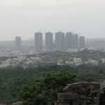
Cresting the hill at 21 miles I saw an immense Gothic church, which Ben informed me was Boston College. I’d never actually been to BC before, but I knew that meant we were close. From here on in landmarks occurred quite quickly and egged us on:
- 21.5 miles: First sighting of a Green B Line T Stop.
- 22.5 miles: Cleveland Circle, the C line, and Beacon St
- 23.2 miles: Washington Sqaure and excellent, but close bar, the Publik House
- 24.0 miles: Coolidge Corner, the first place on the route I would say that I frequent.
- 25.0 miles: The Mass. Turnpike bridge, first sighting of the Citgo Sign and Fenway Park.
- 25.5 miles: Kenmore Square!
- 25.7 miles: Mass. Ave!
- 26.0 miles: Final turn on to Boylston St.!!
- 26.2 miles: Finish line!!!

I crossed the line first in our group of three, having pulled away at the last turn and pushed into my highest gear, which I had only used during the previous but failed push to catch up to Jed. I remember crossing just after 3am, something like 3:05 or so. I know we were well finished by Monday April 18th at 03:17:30am 2011when Ben tweeted that we were with the Boston Marathon! So by the official tweeted times we took 2:26 hours to finish the route on our bikes, which is an average speed of 10.7 mph. I know that when I ride home from work, which include no significant hills I usually hit between 11 and 12 miles per hour, so this is about what I expected the rate to be given the hills and the endurance issue. But like I said, I think the end time is ~10 minutes late, so its more like 2:16 and 11.5 mph, which is surprisingly better than expected. Of course, a non-official world record time of ~2:02 was set today on the same course, with the same tailwind by a non-bike-aided individual. It doesn’t feel that great to be slower on a bike than someone running, but it is still the most significant athletic accomplishment I’ve made since I stopped running cross country in high school (where my longest run was ~8 miles).
Those of you who checked my twitter feed know I took at spill at Cleveland Circle. I fell when my front tire got locked into a trolley rail in the road between the B and C lines in the middle of the intersection. It would have been a really bad place to crash at rush hour. I was simply not paying attention to the hazard and attempted to cross the rail at a ~15deg (very shallow angle) and as such, I was thrown off to the left side. I landed mostly on my left hip, at least that is the only thing that still hurts. I manage a skin deep scrape on my left fore arm just above my elbow and a deeper scrape below my left knee. I was, of course, wearing a helmet, but my head did not hit the ground at all. I immediately yelled that I was ok, got up, and picked up the bike, which was also in good shape. I walked my way over to an Island in the intersection and checked my scrapes for severity. Finding them to not be too bad, I continued on.
Of course, Copley square is 4.4 miles from my house, and it is ~3:30am by the time we were ready to leave Copley, so the T is not running. We have bikes too, so cab’s are out of the question. This ride, most of which I have done with some regularity was hard. For one, it was into the wind. We had befitted the whole ride from a strong tail wind, and now we had to fight it across the Harvard Bridge. By central square I was seriously considering either taking a break in the CVS (the only thing open) or locking my bike up and taking a cab home, but we didn’t. Near Harvard we almost ran over a drunk guy. Pushing up the ever so slight hill from Harvard, I eventually just had to take a break .2 miles from my house, but I finished strong once on my street. We arrived home to find Andreas taking a slight catnap from packing for his return to Canada. I had some water, Pineapple slices, Resse’s easter eggs, cuscus, and managed to crawl up the stairs and into bed by 4:30am.